Sunderland Heritage Walking Trail: A Self-Guided Route
A self-guided walk of about 4.5km through Sunderland's history, from St Peter's in Monkwearmouth over Wearmouth Bridge to Keel Square, Holy Trinity, Sunniside and Mowbray Park.
Sunderland's history is easy to walk. Within a few kilometres of the city centre you can stand in a church founded in the 670s, cross a river once lined with shipyards, follow the names of thousands of Wear-built ships set into the paving, and finish in a Victorian park. This self-guided trail links seven stops on both banks of the Wear. It covers about 4.5km and takes two to three hours at an easy pace, longer if you stop to look inside the buildings that are open.
The route starts in Monkwearmouth on the north bank and ends at Mowbray Park, a short walk from Park Lane Interchange and Sunderland station, so you can head home from there. Most of it is on pavements and riverside paths. There is one climb from the river up to the bridge, and a few gentle slopes in the old East End.
A note before you set off: the National Glass Centre, which used to be a natural first or last stop on the north bank, closed permanently on 31 July 2026. You will pass the building on the riverside, but it is no longer open to visitors. Sunderland Museum and Winter Gardens, at the end of the walk, is also closed while it is refurbished (more on that below).
Stop 1: St Peter's Church, Monkwearmouth
Start at St Peter's, on the north bank near the University of Sunderland's St Peter's campus. Benedict Biscop founded the monastery here in 674 to 675, and the west wall and porch of his church still stand, with the tower raised above the porch by the late 10th century. It is one of the oldest church buildings in England, is listed Grade I, and is still an active parish church. The Venerable Bede began his life as a monk in this community before moving to its twin house at Jarrow.
Take a few minutes in the churchyard to look at the west front, where the different phases of Anglo-Saxon stonework are easy to pick out.
Best for: St Peter's suits anyone who wants to see the place where Sunderland's written history begins.
Stop 2: The north bank riverside
From St Peter's, follow the riverside path west, upstream, towards Wearmouth Bridge. This stretch of the Wear was lined with shipyards for well over a century, and the open ground and new buildings along the bank mostly stand on former yards. You pass the closed National Glass Centre early on. Further along, the path gives good views across the water to the old town on the south bank and to the arches of the bridges ahead.
Allow about 1.2km from St Peter's to the bridge. Before you climb up to cross it, it is worth a short detour to Monkwearmouth station on North Bridge Street, a classical building of 1848 that now houses The Fans Museum of Sunderland AFC history. Its opening days vary, so check before you go.
Best for: The riverside path suits walkers who want the shipbuilding story told by the river itself.
Stop 3: Wearmouth Bridge
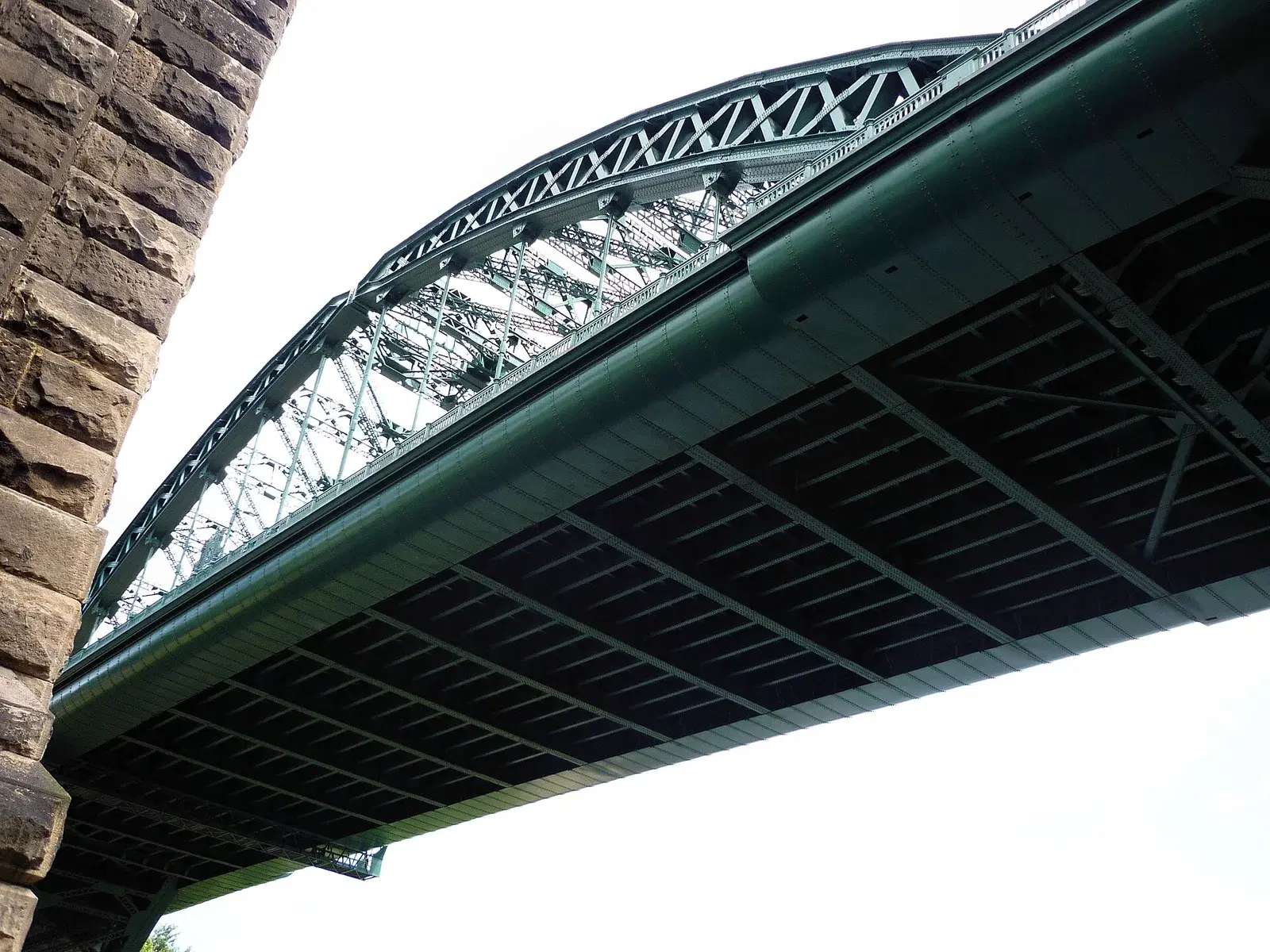
Wearmouth Bridge carries the main road between the two halves of the city. The first bridge here opened in 1796, a cast-iron span promoted by Rowland Burdon that was among the longest single-span iron bridges of its day. The present green steel arch, built by Sir William Arrol and Co., opened on 31 October 1929 and was built around the old bridge so that traffic could keep crossing. Just upstream, the railway bridge of 1879 still carries trains and Metro services into the city.
Walk across on the downstream side for the view towards the river mouth and the piers at Roker.
Best for: Wearmouth Bridge suits anyone who likes engineering, and gives the best view on the route.
Stop 4: Keel Square
At the south end of the bridge, turn right into Keel Square. The square was completed in May 2015 at a cost of £11.8m. The Keel Line running through it marks out the length of the Naess Crusader, the largest ship ever launched on the Wear, and the paving carries the names of more than 8,100 ships built on the river. It is a good place to look for a ship with a family connection, and the Keel Tavern on the square is a convenient place for a drink or lunch at roughly the halfway point.
Best for: Keel Square suits families tracing a shipbuilding ancestor, and anyone ready for a break.
Stop 5: Holy Trinity and the old East End
From Keel Square, walk east along High Street West and High Street East, about 1km, into the old East End, where Sunderland began as a port. Holy Trinity Church on Church Street East was built in 1718 to 1719 as the parish church for the new town of Sunderland, and was consecrated on 5 September 1719. It is listed Grade I, with an apse added in 1735. It closed as a parish church in 1988 and is now cared for by the Churches Conservation Trust, which completed a £4.3m restoration and reopened it as Seventeen Nineteen, a heritage and community venue. It is usually open from Wednesday to Friday, 10am to 4pm.
In the churchyard is the headstone of Jack Crawford, the Sunderland sailor who nailed Admiral Duncan's colours to the mast at the Battle of Camperdown in 1797. Next door on Church Walk, the Donnison School Heritage and Education Centre occupies a Georgian charity school of 1798 and holds open days and talks.
Best for: Holy Trinity and the Donnison School suit anyone curious about Sunderland's Georgian beginnings as a port town.
Stop 6: Sunniside
Head back west and uphill for about 700m to Sunniside, the area between Fawcett Street, Borough Road and the ring road. In the Victorian period this was the city's business district, home to banks, shipping offices and foreign consulates, and many of its grand stone buildings survive. Sunniside Gardens, at its centre, were redeveloped in 2007. Walk the streets around the gardens and look up at the upper floors, where the carved names and dates of the original firms are still visible.
Best for: Sunniside suits anyone who enjoys Victorian architecture and a quieter few streets away from the shops.
Stop 7: Mowbray Park
Finish about 500m south in Mowbray Park, laid out in the Victorian period on the edge of the old town. The park is full of memorials: a statue of Major-General Sir Henry Havelock of 1861, a statue of Jack Crawford of 1890, and a statue of John Candlish, a Sunderland MP, of 1875. The William Hall drinking fountain dates from 1878. The memorial to the 183 children who died in the Victoria Hall disaster of 1883 was returned to the park in 2002.
Sunderland Museum and Winter Gardens, beside the park, closed in August 2026 for a £13.6m refurbishment and is due to reopen in 2028. The park itself remains open.
Best for: Mowbray Park suits a quiet end to the walk, with benches, the lake and plenty to read on the monuments.
Planning your walk
The full route is about 4.5km. If you prefer a shorter walk, start at Keel Square and visit stops 4 to 7, which is about 2.5km. Seventeen Nineteen and the Donnison School have limited opening days, so a Wednesday to Friday visit lets you see inside both. For more history before you go, read our short history of Sunderland. If you want to keep walking, our best walks in Sunderland guide and the Roker and Seaburn seafront guide pick up where this trail ends, and there is more on the heritage hub and the outdoors hub.
Know a stop we have missed? Get in touch.
Local businesses mentioned
The Fans Museum
Monkwearmouth Station, North Bridge Street, Sunderland, SR5 1AP
Keel Tavern
Unit 2, Holiday Inn, Keel Square, Sunderland, SR1 3DS
Donnison School Heritage and Education Centre
Church Walk, East End, Sunderland, SR1 2BJ
Sunderland Museum and Winter Gardens
Burdon Road, Sunderland, SR1 1PP
Never miss what’s on
Join the weekly SunderlandCity.live digest — the best events, news and local tips, straight to your inbox. One email a week.
What's On
Witches, Fairies and Satan: Folk Tales of County Durham
1:00 PM · Arts Centre Washington, Biddick Lane, Fatfield, Washington, NE38 8AB
Frozen Assets
7:30 PM · Arts Centre Washington, Biddick Lane, Fatfield, Washington, NE38 8AB
Spotlight: Washington Open Exhibition 2026
See website · Arts Centre Washington, Biddick Lane, Fatfield, Washington, NE38 8AB